


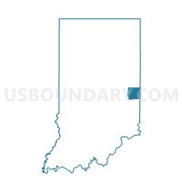
BOSTON 01, Wayne County, Indiana
About
Outline

Summary
| Unique Area Identifier | 581189 |
| Name | BOSTON 01 |
| County | Wayne County |
| State | Indiana |
| Area (square miles) | 24.79 |
| Land Area (square miles) | 24.67 |
| Water Area (square miles) | 0.12 |
| % of Land Area | 99.51 |
| % of Water Area | 0.49 |
| Latitude of the Internal Point | 39.75486480 |
| Longtitude of the Internal Point | -84.87962700 |
Maps


Graphs
Select a template below for downloading or customizing gragh for BOSTON 01, Wayne County, Indiana


Neighbors
Neighoring Voting District (by Name) Neighboring Voting District on the Map
- ABINGTON, Wayne County, IN
- BROWNSVILLE, Union County, IN
- CENTER 05, Wayne County, IN
- HARRISON, Union County, IN
- PRECINCT DIXON, Preble County, OH
- PRECINCT JACKSON, Preble County, OH
- WAYNE 03, Wayne County, IN
- WAYNE 34, Wayne County, IN
Top 10 Neighboring County Subdivision (by Population) Neighboring County Subdivision on the Map
- Wayne township, Wayne County, IN (41,217)
- Center township, Wayne County, IN (7,579)
- Jackson township, Preble County, OH (1,190)
- Boston township, Wayne County, IN (887)
- Abington township, Wayne County, IN (853)
- Brownsville township, Union County, IN (845)
- Dixon township, Preble County, OH (567)
- Harrison township, Union County, IN (416)
Top 10 Neighboring Place (by Population) Neighboring Place on the Map
Top 10 Neighboring Unified School District (by Population) Neighboring Unified School District on the Map
- Richmond Community School Corporation, IN (42,104)
- Eaton Community City School District, OH (14,201)
- Centerville-Abington Community Schools, IN (8,432)
- Union County-College Corner Joint School District, IN (7,885)
- National Trail Local School District, OH (7,004)
Top 10 Neighboring State Legislative District Lower Chamber (by Population) Neighboring State Legislative District Lower Chamber on the Map
- State House District 77, OH (118,691)
- State House District 55, IN (63,163)
- State House District 56, IN (57,307)
Top 10 Neighboring State Legislative District Upper Chamber (by Population) Neighboring State Legislative District Upper Chamber on the Map
- State Senate District 12, OH (346,477)
- State Senate District 43, IN (129,512)
- State Senate District 27, IN (116,341)
Top 10 Neighboring 111th Congressional District (by Population) Neighboring 111th Congressional District on the Map
Top 10 Neighboring Census Tract (by Population) Neighboring Census Tract on the Map
- Census Tract 9, Wayne County, IN (5,904)
- Census Tract 9607, Union County, IN (4,376)
- Census Tract 107, Wayne County, IN (3,911)
- Census Tract 4601, Preble County, OH (2,926)